
BayGeo + University of San Francisco partnership
The GIS Education Center is a program of BayGeo with our wonderful partners at the University of San Francisco's Geospatial Analysis Laboratory. BayGeo is the Bay Area's non-profit association of mappers and geospatial technology professionals.
Our exclusive focus at the GIS Education Center is training students and professionals to use industry-standard and open-source mapping tools. GIS (Geographic Information Systems) is a technology used to create digital maps and perform spatial analysis. Virtually every discipline and industry uses "geo" for better planning and decision making.
BayGeo + University of San Francisco partnership
Upcoming (0)
Past (18)
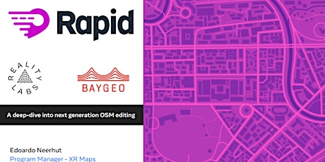
Mapping with Meta's AI-assisted mapping tool: "RapiD"
Thu, Dec 7 • 6:00 PM
Free

Vector & Raster Analysis - Spring 2017
Tue, Apr 25 • 6:00 PM
Check ticket price on event

GIS Quick Start - April 2017 Session
Mon, Apr 17 • 6:00 PM
Check ticket price on event

Python for ArcGIS - Spring 2017
Tue, Mar 21 • 6:00 PM
Check ticket price on event

Web Mapping Quick Start - Spring 2017
Mon, Mar 13 • 6:00 PM
Check ticket price on event

GIS Quick Start - February 2017 Session
Tue, Feb 14 • 6:00 PM
Check ticket price on event

Open-Source GeoStack
Tue, Nov 15 • 6:00 PM
Check ticket price on event

GIS Quick Start - November Session
Mon, Nov 7 • 6:00 PM
Check ticket price on event

Python for ArcGIS
Tue, Oct 11 • 6:00 PM
Check ticket price on event

Web Mapping Quick Start
Mon, Oct 10 • 6:00 PM
Check ticket price on event

GIS Quick Start - September Session
Tue, Sep 6 • 6:00 PM
Check ticket price on event
GIS Quick Start - Summer 2016
Wed, Jun 15 • 6:00 PM
Check ticket price on event
Mapping with Meta's AI-assisted mapping tool: "RapiD"
Thu, Dec 7 • 6:00 PM
Free
Vector & Raster Analysis - Spring 2017
Tue, Apr 25 • 6:00 PM
Check ticket price on event
GIS Quick Start - April 2017 Session
Mon, Apr 17 • 6:00 PM
Check ticket price on event
Python for ArcGIS - Spring 2017
Tue, Mar 21 • 6:00 PM
Check ticket price on event
Web Mapping Quick Start - Spring 2017
Mon, Mar 13 • 6:00 PM
Check ticket price on event
GIS Quick Start - February 2017 Session
Tue, Feb 14 • 6:00 PM
Check ticket price on event
Open-Source GeoStack
Tue, Nov 15 • 6:00 PM
Check ticket price on event
GIS Quick Start - November Session
Mon, Nov 7 • 6:00 PM
Check ticket price on event
Python for ArcGIS
Tue, Oct 11 • 6:00 PM
Check ticket price on event
Web Mapping Quick Start
Mon, Oct 10 • 6:00 PM
Check ticket price on event
GIS Quick Start - September Session
Tue, Sep 6 • 6:00 PM
Check ticket price on event
GIS Quick Start - Summer 2016
Wed, Jun 15 • 6:00 PM
Check ticket price on event
Events
Mapping with Meta's AI-assisted mapping tool: "RapiD"
Thu, Dec 7 • 6:00 PM
Free
Vector & Raster Analysis - Spring 2017
Tue, Apr 25 • 6:00 PM
Check ticket price on event
GIS Quick Start - April 2017 Session
Mon, Apr 17 • 6:00 PM
Check ticket price on event
Python for ArcGIS - Spring 2017
Tue, Mar 21 • 6:00 PM
Check ticket price on event
Web Mapping Quick Start - Spring 2017
Mon, Mar 13 • 6:00 PM
Check ticket price on event
GIS Quick Start - February 2017 Session
Tue, Feb 14 • 6:00 PM
Check ticket price on event
Open-Source GeoStack
Tue, Nov 15 • 6:00 PM
Check ticket price on event
GIS Quick Start - November Session
Mon, Nov 7 • 6:00 PM
Check ticket price on event
Python for ArcGIS
Tue, Oct 11 • 6:00 PM
Check ticket price on event
Web Mapping Quick Start
Mon, Oct 10 • 6:00 PM
Check ticket price on event
GIS Quick Start - September Session
Tue, Sep 6 • 6:00 PM
Check ticket price on event
GIS Quick Start - Summer 2016
Wed, Jun 15 • 6:00 PM
Check ticket price on event